I’m sad to say that as a New Englander it took me until I was forty three to finally climb Mt. Manadnock. What a great trail and what a great mountain this is. I headed up there on a Sunday morning, after wondering what to do with my day I made the decision to drive the two plus hours and get this mountain done for me. The weather that day was hovering around eighty at the base and promised to stay sunny for the remainder of the day. I got to the park around noon and after paying the entry fee I changed into my hiking pants and sneakers, packed my day hiking bag and began my ascent.

I decided to go for the most direct route to the top, as I’m sure most first timers do. So starting from the parking lot I walked past the restrooms and headed up the white dot trail. It promised to be a 1.9 mile trek directly to the summit, I was breathing heavily and sweating within a few minutes. At the first split I decided to go left and head up the white cross trail. The trail signs had no indication as to what type of terrain was ahead of me. The trail was a mixture of stone steps and seemingly random rocks that at some points felt like I was scrambling to ascend.

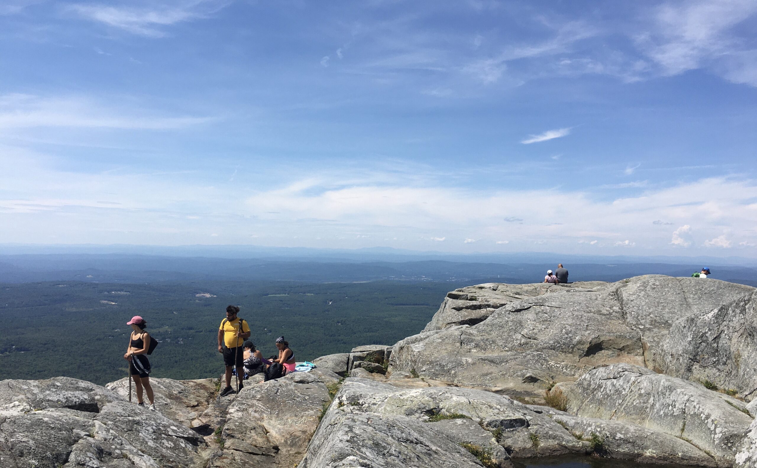
Eventually the white cross trail breaks the tree line and the wind picked up. I was finally comfortable in the pants I chose to wear, the wind was a welcome relief. I finally got a view of the summit but it seemed a long way off, maybe another half mile. Once the white cross and white dot trail reconnect the trail to the top is marked with white paint dots and rock cairns. But the reality is most people just climb in whatever direction looks easiest to them. Here is where I met a seventy year old who claimed to have climbed the mountain four times on his sixty-ninth birthday. He had had a stroke five years prior and dedicated himself to a healthier lifestyle. I saw him then trek straight to the top in the most direct route as I switch backed my way up.


After spending fifteen minutes or so I started me descent. I happened to notice then the sign that labeled the white cross trail as the least steep descent. So apparently I had come up the easy way, it was time to make my way down the white dot trail. Where the trails split the white dot trail ran along the top of a rock precipice offering better views that the white cross had. But once the trail started to drop it got steep quick. There were sections that I ended up just sliding down several feet of rock at a time. As I got further down the switchbacks were there to keep you from having to drop ten foot cliffs over and over. Once the steepest part past there’s a flat section that’s about 150-200 feet. As I was nearing the end there was a family coming the up and I heard the dad proclaim “I think we’re past the worst of it.” When I started laughing I saw the little bit of panic on his face. So I told him what I just experience and wished them luck before continuing down.

Once I was back to my Jeep I knew I needed a beer and some food before the long drive home. Unfortunately Verizon was not able to get enough coverage for me to look up something local. Fortunately on the road out of the park is Dublin road taproom and eatery, I immediately pulled in and found a spot at the bar to enjoy a local beer and some great wings. The place was swarmed with mostly golfers, the public course located in the shadow of Mt. Manadnock must be a very scenic course. If I ever actually learn to play I’ll have to make a trek out here, double up on mountain climbing and driving golf balls.

Check out the Alltrails app to track mileage, time and elevation.
Check out this other blog all about the Franconia Notch area in New Hampshire.

