Carter Preserve in Charlestown Rhode Island is an 1100 acre preserve, established in 2001 by The Nature Conservancy. The land, as beautiful as it is, with the glacial erratic and colonial stone walls, has a dark past. One that can be found while diving deep into the world’s nuclear history, alongside places like Chernobyl and three-mile island.
Walk with me in Charlestown Rhode Island, and discover the radiological history of Wood River Junction, and learn about the tragedy that ended the life of Robert Peabody. Listen to the podcast here to learn more.
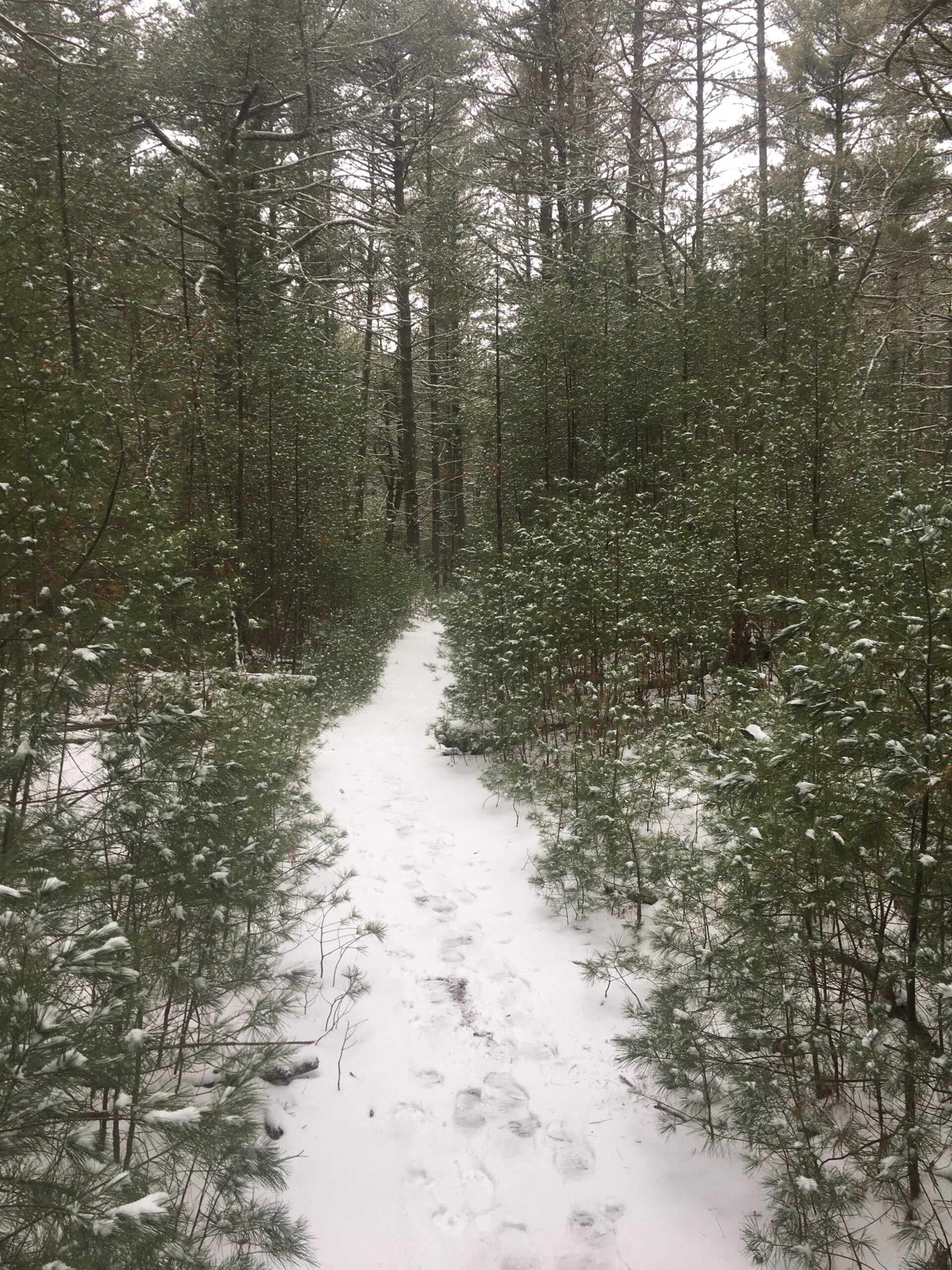
Carter Preserve is a great place to hike in Charlestown RI. The loop trail is a 4.6 mile trail that goes through glacial erratic’s and farmlands, the old stone walls are beautiful to see and experience. The preserve offers scenic views and large open fields to explore. The trails are all well marked and maps are placed at almost all the intersecting trails.

I’ve hiked this trail in every season and I can tell you that it’s a different experience every time. Winter in the preserve is breathtaking, both in the cold air and the views through the forest. parts of the open field had become ice slick under the snow, and I had to warn other hikers of the possible danger. The budding trees of spring and the warming air let you know that the greenery is on it’s way. Summer brings rolling seas of ferns with rock islands, and places where it’s difficult to see the trail under foot for the foliage. And then comes fall. The crisp air and crackling leaves make you remember that nearby Clyde’s Cider Mill has started crushing apples and producing some of the best hard cider, pies and cider donuts you can find.
Clyde’s Cider Mill, Mystic Connecticut
You might imagine it’s a stretch to jump from Carter Preserve in Charlestown RI to Clyde’s cider mill in Mystic CT, but if you’re not a native Rhode Islander you’ll be willing to drive more than fifteen minutes and thus be more than able to make the trek. Starting at the beginning of September Clyde’s starts crushing apples and selling their wares. Everything on the shelves being worth the purchase. Since moving back to Rhode Island it’s been a yearly ritual to don the best flannels, and make the short drive to Mystic and stock up. A dozen donuts, at least two growlers of hard cider, a jug and maybe a bottle of wine later, you’ll be ready to sit by a fire and enjoy the cool autumn air.
The steam powered Cider mill is a sight to see, the staff is more than happy to show you how the press works. Join this experience to a hike through the Francis C. Carter Memorial Preserve in Charlestown and you’ll have a fall experience in Southern New England that you’ll want to write home about. Carter and Clyde’s, hiking and hard cider, two of my favorite things.
For another Connecticut adventure visit Harkness State Park in Waterford.
Podcast transcript
On the nature conservancies website carter preserve is titled “one of south county’s best hiking areas”, and truly it is. The website goes on to say “the trails wind over a landscape formed by glaciers and shaped by generations of farmers. From field to forest, this land has interesting stories to tell”.
Every bit of this statement is true, I’ve hiked every trial of the four interconnected loops, in every season, across most of it’s 1100 acres. From the overlook deck on the vernal pond to the Glacial erratics. From the pitch pine barrens and the rocky hills and around and through the 60 acre grasslands. The stone walls and huge boulders tell the stories of how the land was carved from ice and cultivated by man. But in one corner of the grass field there’s an anomaly, a short, two lane road cutting through a short section of trees, and gated off where it meets a neighborhood. There’s no signs, no markers, no obvious reason for this paved lane to exist. The story of why its there isn’t one you’ll find easily, it’s the story of Robert Peabody, and the nuclear disaster that ended his life.
Intro
Welcome to episode three of tales trails and taverns, the podcast where I seek out haunted woods. Taverns. Hotels, swamps, islands, towns ect. And give you, the listener, a first hand account of what its like to visit these places. The sights, the sounds, the feeling, what to expect and how to prepare for your own adventures. Now, just so were clear, I am not a paranormal investigator, nor am I a medium or clairvoyant in any sense. I am just someone who enjoys the outdoors, enjoys a good beer or a well mixed drink, has seen a few unexplainable things and is actually hoping to see more.
Todays episode takes us to the south coast of Rhode Island to Charlestown, a little beach community that has had a penchant for open spaces for many years. I lived in the town for several years and one of the things I appreciated was how hard the city council fought to keep large commercial projects out of the town. And to keep the open spaces, well, open and accessible to everyone. This has disrupted my own view of other coastal towns, and now everytime I see an old factory, manufacturing facility or trail rail built close to the water, I wonder why they had such short sightedness, and question why they couldn’t have tried to preserve the coast as well as Charlestown has. Of course the low income housing project started by the Narragansett tribe, that has sat abandoned since the mid 90’s, could probably tell a darker tale about battling progress. But I’ll leave that for another episode.
Carter preserve
The Carter preserve, that sits straddling the rocky uplands of the Charlestown Moraine, is a connector for several thousand acres of forest. It is part of an 11 mile stretch of protected land connecting the Ninigret national wildlife refuge to the Carolina Management area in Richmond Rhode Island. The preserve also serves as protection for a mile long stretch of the Pawcatuck river.
Parking
There’s few different ways to start on these trails, the one I found first is directly off of 112. It’s a small lot near a vernal pond that, depending on what time of year you go, may look like a pond or a small, open section of grassland. You’ll notice a sign next to the trail head map that warns you to avoid the trail during high winds. Unfortunately this is accurate. The hard woods, I believe the oaks but I could be mistaken have been decimated by either an invasive species or a disease, and much of the area is a graveyard of dead, but still standing trees. High winds and gusts can easily knock down branches or even whole trees at any time. So be cautious if you travel here.
The second way Ive found is along old mill rd, this is my favorite one to start at currently because you can quickly get to the Glacial Erratics from the first intersection, or go straight and head into the open grasslands.
The third trail head is the western trail head on 411 in Wood river junction and since I’ve never started here, or even walked out to it I have nothing of value to tell you about.
Red Loop
What I can tell you about is the rrest of the trails, on the red loop trail, past the stone chimney the glacial erratics section is one of my favorites, it winds through huge boulders and over rocky hills with views of long stone walls bisecting the woods in all directions. This then connects to the Narragansett trail and through the center of the grass lands
Yellow and Blue Loop
Connected to this is the yellow trail, it continues around the rest of the grasslands and goes back to the old mill trail head parking via the sheep path. The next loop is the blue trail, at the farthest point it walks along the ice pond. I’m going to go out on a limb here and say that this might be a spot where early settlers gathered ice from in the winter for storage over the warmer summer months. The rest of this trail goes through an open forest setting. In late summer the trail can get quite overgrown with waist high foliage and ferns. To the point where even on the path, you cant see the ground, or even below your waist. I remember it just looking like a rolling sea made of ferns. There was a large boulder about fifty yards off the trail, I wanted to walk to it and climb it, like an explorer finding a new island. But I wasn’t entirely sure if I could have found the path once I left it. Also I didn’t want to be picking ticks off of myself for the remainder of the hike. It also felt like it could have been right a scene right out of a low budget horror movie. Some creature, only 3 feet tall, moving quickly through the ferns, surrounds me, the protagonist while I’m on the rock. Keeping me from getting back to safety. After several hours not seeing any movement, I make a dash for the trail, only to realize that there’s more of them, and they drive me deeper into the field. Netflix, call me.
Orange Loop
The eastern most section is the orange loop, this one travels through deeper forest past a historic dam, and many more boulders. And it connects to the small white loop near the 112 trail head and the vernal pond.
The last trail head is probably the most interesting one. This one is near Botka woods drive and it has a gate. Instead of leading from the gate directly onto a trail you walk first along a two lane paved road. It goes to the edge of the field to what looks like it could be a gravel parking lot. There are no signs, no markers, nothing to let you know what this area was. But if you were to look up nuclear accidents, you would find the united nuclear wood river facility on the list along side places like Chernobyl and three mile Island. The area at the end of this small road was the location of a criticality accident in 1964. Resulting in the death of Technician Robert Peabody. Opened in 1963 the facilty was designed to recover highly enriched uranium from scrap material left over from fuel production. Due to poor labeling and using similar shaped containers Peabody mistakenly added uranium solution, instead of trichloroethane to a tank he was intended to clean. The Sievert being a unit of measure for radiation exposure, 2-10 in a short term would cause extreme radiation sickness and would likely be fatal. Peabody was exposed almost instantly, over his entire body to 82-190 sieverts. Robert died 49 hours after exposure at Rhode island hospital. There is a very informative youtube video by Jason Allard titled abandoned nuclear facility, wood river junction criticality accident, rhode island. It details the accident and the events that took place before and after.
Wood River Junction Nuclear Criticality
After a cleanup due to 14 violations found after the accident, the plant reopened in 1965 and remained opened until 1980, when reduction in profits caused the plant to be abandoned in the companies search for better investments. A 1979 survey had found that the site of the plant had leaked radiation into the immediate area prompting a cleanup. The buildings were eventually demolished in 1994 and the site was determined to be safe in 1995.
Today the area is pristine, if you have a keen enough eye you can find the outlines of the nuclear facility buildings near the edge of the grasslands. Like I said earlier the road leading in is still mostly there, partially overgrown, and the radiation that was once present is now gone. You’d be exposed to more radiation by eating a banana than you would walking through Carter preserve.
That concludes the tales and trails portion of the podcast, thank you all for joining me, if you haven’t already follow me on social media, you can find tales trails and taverns on Instagram, facebook, youtube, threads and tictoc. Click subscribe on your podcast provider for new episodes, and don’t forget to leave a five star review.
General Stanton Inn
Now, once youre done hiking Carter Preserve and you’re looking for a frosty beverage to quench your thirst, I am going to have to point you to the General Stanton Inn. I have personally not been there yet, the reason is is that for the years I lived in Charlestown it was closed and for sale. In 2022 the inn was renovated and has since reopened. But for years I’ve heard about hauntings in the inn by locals. Makes since seeing ass the inn originally opened in 1740 and has stayed open for most of that time since. So when you find yourself in Charlestown in need of a drink and spirits, find yourself at the General Stanton inn, particularly in the prohibition room. Then thank me in the five star review you write after.
Have a good night Y’all, happy spooky season, go hiking, see a ghost, drink beer, repeat.


